+ 2,000 destinations find now !

Showing posts with label quintana roo. Show all posts

Xcalak is one of the last unspoiled corners of the Mexican Caribbean

xcalak quintana roo

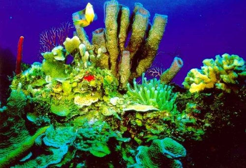
Xcalak is one of the last unspoiled corners of the Mexican Caribbean located to the south of Costa Maya. The second largest Great Barrier Reef in the world is just off the coast of Xcalak and is also close to Banco Chinchorro, a Mexican Atoll and a national reserve. It is an excellent site for diving. Also located 60 kilometers south of Mahahual, Mexico, a major tourist destination.

Earlier, he communicated with the city of Chetumal via a ferry, now his only communication is the road that connects it to Mahahual. Xcalak is the Canal de Zaragoza, a channel that allows communication from the Bay of Chetumal, the Caribbean Sea without passing through territorial waters of Belize. A 15km south is Huach River, also part of the ecological park of Xcalak.

This area is famous for its fantastic fishing, and is also great for trolling, though few people have done. All year we caught sierra, mackerel, tuna, barracuda, grouper, snapper and tarpon. From April to June there is a lot dorado, marlin and sailfish.


Xcalak is a village of 252 inhabitants on the Caribbean coast of Mexico in the state of Quintana Roo and Municipality of Othon P. White. Xcalak is one of the last unspoiled corners of the Mexican Caribbean located south of Costa Maya.The second largest Great Barrier Reef in the world is just off the coast of Xcalak and is also close to Banco Chinchorro, a Mexican Atoll and a national reserve. It is an excellent site for diving. Also located 60 kilometers south of Mahahual, Mexico, a major tourist destination. Mahahual is being developed for the tourism industry.

Earlier, he communicated with the city of Chetumal via a ferry, now his only communication is the road that connects it to Mahahual. Xcalak is the Canal de Zaragoza, a channel that allows communication from the Bay of Chetumal, the Caribbean Sea without passing through territorial waters of Belize. 15 km north of Xcalak is Huach River, part of the ecological park of Xcalak.

This area is famous for its fantastic fishing, and is also great for trolling, though few people have done. All year we caught sierra, mackerel, tuna, barracuda, grouper, snapper and tarpon. From April to June there is a lot dorado, marlin and sailfish.

The great variety of plants and animals found in Xcalak, both in the marine environment as the land and the lake systems, make this area unforgettable landscape display a window.

Xcalak is great place for diving, snorkeling, fishing, swimming and just relax and unwind.

Visit Xcalak Costa Maya on the call, here is the place for you, an unexplored paradise off the roads rough, but with a new road and air service from Cancun.The Costa Maya has the best scuba diving, snorkeling and fishing that Quintana Roo, Mexico and the Caribbean can offer.


Ver mapa más grande

Banco Chinchorro is a coral barrier reef, part of the reserve reefs of Mexico

Banco Chinchorro

It is located in the Mexican Caribbean off the coast of the municipality Othon P.White state of Quintana Roo has four sandy areas emerged Cayo Norte, consisting of two small bodies with an area of ​​0.9 square kilometers, Cayo Centro, the largest extension to 5.6 square kilometers with 0.2 Cayo Lobos, the latter located in the southern end.


30 miles is separated from the mainland. Access is only by sea from Majahual and Xcalak.

Banco Chinchorro is a coral barrier reef, part of the reserve reefs of Mexico, the second largest reef chain in the world, the biosphere reserve of Banco Chinchorro is in the state of Quintana Roo, the municipality of Othon P. White is part of the natural attractions of the Caribbean, particularly those found in the Yucatan Peninsula, and the great Mesoamerican reef system, reef or reserve in Belize, is the reservation of Xcalak, just off Rio's beaches and Majahual Huach, the Banco Chinchorro atoll is Mexico's largest and second largest in the world.


With its tropical climate, which allows for multiple ecosystems, the Mexican government has provided large areas of forests and reefs are declared as ecological reserves. One of them, little visited by tourists, who prefer to spend their vacations in places like Cancun, Isla Mujeres, Playa del Carmen and Punta Allen, is the Biosphere Reserve Banco Chinchorro.

This ecosystem is considered an isolated coral atoll, and its name derives from the resemblance to a semicircular Caribbean network used for finfish fisheries in coastal waters. It has an area of ​​nearly 800 km2, consisting of a sandy outcrop of 46 km long and 15 wide. In its eastern perimeter has a long barrier reef with sections of white water trails where they break, and the west they are discontinuous and fail to emerge to the surface. The waters of the reef lagoon, connected to the open sea, have an average depth of 5 m, but the most interesting place is the presence of land that is scarce but allows visitors to stay in one of four islands distributed in the center and the north and south.


felipe carrillo puerto Located 157 kilometers from the state capital, Chetumal

felipe carrillo puerto

Located 157 kilometers from the state capital, Chetumal and 230 km from Cancun.Felipe Carrillo Puerto is the State's cultural identity.
It is located in the central region of the State of Quintana Roo, in its territory theBiosphere Reserve Sian Ka'an World Heritage Site. Its geographic location isconsidered as a meeting point and transfer to any destination in the state.

Our people, proud of its roots offers all visitors a warm and unique experience, full of traditions and customs of the Mayan Culture


Ver mapa más grande


chemuyil, solidaridad, quintana rooo

Chemuyil, solidarity, quintana roo

Chemuyil Town locality is situated in the municipality of Solidaridad (in the State ofQuintana Roo). Has 1239 inhabitants. Chemuyil City is 5 meters.
Chemuyil Maya is a small village located about 5 km. south of Akumal. The town is home to many residents who work in and around Akumal.

Chemuyil is really the tourist map, but it is the closest town to the beach Xcacel. You will find restaurants and mini-supers [Leo's Pizza and La Palapa] in the city.

There is a subdivision next to the city that was created as a housing project for theMexican government, but unsold homes and were placed in the open market


Ver mapa más grande

xcacel, solidarida, quintana roo

Xcacel, solidarity, quintana roo

It is a large bay lapped by turquoise waters. Xcacel is located 100 km south ofCancun, this place is of great ecological wealth and you can admire differentecosystem types in 362 hectares of forest where there are mangroves, cenotes andcoral reefs.

Xcacel is one of the few spots of green turtles, endangered species, which remain in the Atlantic.

Are also located in this area caves for scuba diving and snorkeling in crystal bluewaters, is an unforgettable experience. During the past 5 years the development of tourism in the area of ​​the Yucatan peninsula has led to the building of modern 5-starhotels along the coast.
Xcael beaches and Xcacelito is a privileged area where different types of ecosystemsfound in 362 acres of jungle and beaches where there are mangroves, cenotes andreefs


Punta Herrero is located in the Municipality of Felipe Carrillo Puerto, Quintana Roo State and is in the GPS coordinates:

art smith

Punta Herrero is located in the Municipality of Felipe Carrillo Puerto, Quintana Roo State and is in the GPS coordinates:

Length: 872745

Latitude: 191915

The town is at a median height of 5 meters above sea level.


you can enjoy the camps by the sea, whilst taking his eyes so as to countless species of birds, fish and plants that inhabit this area so lucky the state of Quintana Roo.

You can get there by road-Uvero Mahahual, from the latter and moving toward the northeast, or you can reach by boat from Punta Allen, meanwhile, you can enjoy the wonderful views offered by the Caribbean Sea, the marine species will soon take a look at the surface to the delight of the ride.
Punta Herrero ecotourism is a place located within the Biosphere Reserve Sian Ka'an, a header 196 km south of town, taking the intersection of Cafetal - Mahahual, safe place for people who wish to seek a peaceful atmosphere and direct contact with nature, kayak the canals and mangroves, or snorkel on coral reefs, admiring the richness of its flora and fauna

For lovers of outdoor adventure, there are countless attractions to enjoy 100%, the fishing community of Punta Herrero, located within the municipality, 196 km. in the Biosphere Reserve Sian Ka'an, taking the road coffee - lemons. Economic activity and trade is the lobster catch


Ver mapa más grande

Lagoon Chichankanab, in the municipality of José María Morelos,

Lagoon Chichankanab (Yucatec Maya:small Laguna )? is a gap that is in the northwest Mexican state of Quintana Roo, in the municipality of José María Morelos,has an approximate length of 30 kilometers ranging from population to that of the presumed Kantemó in the same municipality.

Chichankanab is a system of freshwater lakes that run north to south over 25 miles in a straight line. The system consists of the lagoon, the largest in size, with a total of452.02 hectares and is the largest body of freshwater in the interior of the Yucatan Peninsula. The lake has at least five species of endemic freshwater fish. The formationof the lagoon system, the second largest fresh water of the Yucatan Peninsula is a product of a geological fracture.


yal ku lagoon and natural park

yal ku lagoon

This wonderful lake view that just invite you into its clear waters, is the outlet of an underground river that mixes with the sea, so its water is brackish (a mixture of freshwater and saltwater).

The site has parking and toilets, do not have to rent snorkel gear so it is recommended to take.


The waves are so smooth at the join where the lagoon and the sea that is seamless, there are also plenty of rocks that allow multi-colored fish such as golden cows, parrotfish, blue barbers triggerfish, sea urchins, sea stars, damsels and sergeants .
Yalkú lagoon, near Akumal, is connected to the sea, and the mixture of fresh and salt water provides an ideal ecosystem for communities of parrot fish, turtles and other large tropical fish.

All these things can be observed by snorkel (snorkeling) in the lagoon, experience strongly recommended.
Access is from the main road, a few kilometers past the Hotel Kantenah Southbound (towards Tulum). I think the entry points as North Akumal and Half Moon, because there meteis you and going through the streets of a residential community to reach at the entrance to Yal-ku. It is easy to locate. Maybe there is another more direct input from the road, we entered by the development.


-------------------------<<<<<<<<<<<<<<<<< 

natural park yum balam, quintana roo

The observation of flora and fauna is one of the best activities in the biosphere reserve, which lies on the northwestern edge of Quintana Roo, adjacent to Ria Lagartos.


Its area of 154.052 hectares. contains marine ecosystems, wetlands and rainforests.


Wildlife have been registered about 311 species, among which are flamingos, turkeys ocellated, parrots Yucatan, Yucatan orioles king vultures, and five neotropical cats: jaguar, puma, ocelot, tiger and Margay, reptile species like the turtle White, loggerhead and hawksbill turtles, and crocodiles moreleti and acutus.


Also exist in the area more than 30 species of land birds migrate along the route transgolfo.
In this place of beautiful clear waters abound dolphins and whale sharks as well as large areas of wetlands and tropical forests rich in flora and fauna.

In the 60,000 acres of jungle cats live five wild species of tropical Mexico, the jaguar, puma, ocelot, margay (small wild cat) and yaguarundi or jungle cat, all in danger of extinction.

Yum Balam start a software which invites residents to notify technicians of the reservation when it detects the presence of a cat, they capture the animal and take it to another area of the zone, thus contributing to the conservation of species andsustainable development of local communities.
Location

The southern boundary is located approximately 20 km northwest of Kantunil Kin, covering the coastline of the mainland portion of the municipality of Lázaro Cárdenas, Laguna Yalahau and Holbox Island, the northern boundary at sea (Yucatan Channel ), 18 km north of Isla Holbox. The eastern boundary is consistent with the municipal division between the cities of Lázaro Cárdenas and Isla Holbox.

Municipality of Lázaro Cárdenas


Surface

154, 052 has


Cities, towns and other settlements

major human within the zone of influence

Kantunil Kin, Chiquilá, Holbox, Cabo Catoche, Cancun and Leona Vicario.


Xcaret Eco Theme Park is located on the Riviera Maya,

Xcaret Eco Theme Park is located on the Riviera Maya, 5 km south of Playa del Carmen and 75 km south of Cancun in Quintana Roo state, Mexico. To the Maya this site was an important port and commercial center, which they called Polé and which still can appreciate their archaeological remains.

Since its founding in 1990, due to its exceptional natural environment, Xcaret has developed several programs for the conservation and reproduction of flora and fauna typical of the Mexican southeast, such as sea turtles, manatees, spider monkeys, deer, etc. . Among its facilities is the first butterfly in Mexico and the Coral Reef Aquarium, one of the few places in the world where you can see reef structures in their natural habitat.

Theme park, Xcaret is characterized by displaying the natural and cultural representative of Mexico. Besides you can do various water sports in cenotes, underground rivers, lagoons and beaches can be admired traditions of the Maya people and pictures of Mexican folklore.

Talking at Xcaret is talk of a paradise. Here wisely combine natural beauty, rich culture and traditions. Xcaret is an experience of life that deserves to be discovered little by little, without haste. This beautiful place is built on the ancient Mayan port Polé, dramatically framed by the turquoise waters of the Caribbean Sea and lush tropical jungle. Xcaret was created to promote the enjoyment of visitors to respect mother earth and the cultural heritage of the Maya world, fostered the love for the environment through knowledge and harmony, so


kohunlinch, mayan ceremonial center


Kohunlich is the name of a city and Mayan ceremonial center, located about 65 kilometers from Chetumal, Quintana Roo, in the Rio Bec region, near the border between Mexico and Belize.

Archaeological information available suggests that Kohunlich received its first  habitants around the year 200 AD, although most of the most significant buildings were developed between the years 250 and 600 AD Kohunlich can also be assumed to represent a focal point of trade between the cities of the Yucatan Peninsula and Mayan cities in Central America.


Kohunlich site is relatively large, about 21 acres surrounded by tropical forest. The layout of the buildings and the remnants of water pipes and tanks suggests that Kohunlich was an important city at the time. In this site are about 200 mounds, although many still remain inexcavados and invaded by the vegetation still


Address and access roads, is located 69 miles west of the city of Chetumal, capital of the state. The site is accessed via U.S. Highway 186 Chetumal - Escárcega; to get to mile 60, which corresponds to the town of Francisco Villa, should be the deviation of 9 km that leads directly to the site.


Main structures: Principal structures: the site consists of a series of ceremonial architectural and residential character, some of which may have functioned as family neighborhoods or high-level groupings. Currently, the tour begins in the residential complex associated with the Acropolis, which shows an interesting set of residential buildings equipped with benches, niches and various items associated with everyday life.

Although recent findings in the Joint Ya'axná have changed the idea that until recently was available about the early occupation of Kohunlich must be said that the building of greater importance is symbolic and ritual, of course, the Temple of the Masks , which was discussed above, within the group of high-level structures should also be included to those of the Stela Plaza (the Palace of the Stones, the grandstand and the King), within which were possibly carried to public or administrative activities. The Acropolis, one of the great sets of the site, also belongs to high-end residential buildings.


Building A-1 or masks is one of the most popular because it has monumental stucco reliefs still retain the red paint that covered the entire temple. It is likely that this building was built during the Early Classic period and has more to do with the style known as Petén.


puerto morelos, quintana roo

Puerto Morelos Riviera Maya
Its reef (declared a National Park) is part of the second largest barrier reef in the world and is only 500 m from the beach. Ideal for diving, windsurfing, snorkeling and other marine activities. South of the entrance of the town is a botanical garden (sanctuary of the Mayan jungle) of 65 ha in size where you can enjoy flora and fauna (spider monkeys, coati) in the region north of the entrance is a small zoo that is home to boas, ocelots and crocodiles main attraction of all ages.

Activities in Puerto Morelos
In Puerto Morelos there are many things you can do, such as relax in one spa taking an exotic treat me, take a snorkeling or diving tour to the Marine National Park to admire the second largest coral reef in the world and many fish ated is in that also you can take a tour to explore the jungle and cenotes of Puerto Morelos.

Gateway to the Riviera Maya, with its warm and friendly, offers sightseeing and all sorts of activities for couples, friends and families alike. In the Marine Park Natural Reef Puerto Morelos "will find a variety of colorful tropical fish, dolphins and turtles, including its beautiful coral formations that will amaze those who visit. Puerto Morelos offers an unforgettable vacation, quiet and somewhat bohemian


Ver mapa más grande

fuerte de san felipe, bacalar, chetumal

This fort, built by the Spanish in Bacalar in the year of 1733 to defend the town from the incursions of pirates and smugglers of logwood, has a viewpoint and 4 strongholdsdedicated to San José, San Joaquin, San Antonio and Santa Ana.

bacalar in the Bay of Chetumal


Puerto Aventuras is located 84 km. South from Cancun

Puerto Aventuras is located 84 km. South (56 miles) from Cancun and only 18 km.South (12 miles) from Playa del Carmen. Other places nearby are: Puerto Morelos, Tulum (20 minutes ... The only Mayan walled city on the coastline.), Akumal and Cozumel (The largest island in Mexico, a paradise for divers ... Just 50 minutes Aquaworld's ferry leaving the Navy PA, or 20 minutes drive from the city of Playa del Carmen, taking a ferry to arrive in 50 minutes on the island).


A little less than 20 miles from Playa del Carmen have one of the first resorts outside of the Riviera Maya. However, urban growth has not been fired and has all the charms of a beautiful and quiet village, just 240 hectares and 3 miles of glorious beaches await. Being so close, the transport facilities are many: van, bus, rental car (rented say there), taxi ... even bicycle.

The type of construction is most common in the area: complex inside include everything needed to enjoy a relaxing holiday with idyllic landscapes. But visitors can also enjoy many activities.

As I mentioned, their proximity allows you to easily something that is famous Puerto Aventuras Riviera Maya: its cuisine. And, despite not being a place too long, holds within it the most prestigious restaurants of various types of food. Approach simply to eat and take a relaxing stroll back is something we can do any day of which we are in Playa del Carmen.

In addition to the usual water activities in the cenotes, this stands out as having a privileged place from which to perform jumps of at least 4.5 meters (15 feet). It has bathrooms and bar, and tables where we eat our own food if we (see diving in Playa del Carmen).

An important recommendation is to not ever go on a Sunday, because this is the cenote choice for locals to spend their day off work and find it crowded.


Playa del Carmen diving


PLAYA DEL CARMEN
Some famous places along the coast of Playa del Carmen are: Turtle Reef, Barracuda Reef, Moxche and Punta Venado. All of these reefs are easily accessible by boat, dance the waltz with turtles swimming peacefully in the stream, admiring the green moray eels and manta rays resting in the sand. You can also dive Mama Viña, a wreck that invites you to discover the secrets and contrasts of light and dark. Look pass the barracudas and seahorses with a wonderful blue.

COZUMEL
The largest island on the east coast has a tremendous variety of marine life. Meetings with toadfish, turtles and sea stars are common. From April to September is the best time to see the frogfish, but can also be seen at other times of year.


The reef dives include:


transportation by boat to the dive site.
Certified diving instructor
tanks
weights
snacks


Locations for immersion:
Green wall
Known for its tube coral, turtles and a wall 10 meters of hard and soft coral in contrast with mounds of sand. A deep dive for experienced divers.


Feet minimum depth 20m/70
30m/100 feet maximum depth
Visibility 30m/100 feet


Moc Che
It is the smallest of the shallow sites, with an abundance of coral formations. Near the end of the reef is a small bow full of fish and sponges.


Feet minimum depth 7m/24
14m/50 feet maximum depth
Visibility 20m/70 feet


Chun Zumbul
A site along shallow reef full of coral gardens and caves, is home to many schools of yellow grunts, donkeys catalina, eels, green and mottled brown and pagualas.


Feet minimum depth 6m/20
12m/40 feet maximum depth
Visibility 25m/85 feet


Gardens
Named for its garden-like vegetation, this point is covered with sea whips and other tree like plants that are the perfect home to abundant marine life.


Feet minimum depth 6m/20
12m/40 feet maximum depth
Visibility 20m/66 feet


Sabalos
A shallow reef but challenging due to strong currents. It is a combination of coral gardens and sandy soil with various types of starfish. There are small caverns can be explored.


Feet minimum depth 6m/20
12m/40 feet maximum depth
Visibility 20m/66 feet


Barracuda
This hand-shaped reef provides the diver with many options to explore. There are many small holes, and with some luck and good eyesight, you can see some barracuda that is patrolling the site.


Feet minimum depth 6m/20
12m/40 feet maximum depth
Visibility 20m/66 feet


Los Arcos
A deep dive with coral walls and arches are ideal for experienced divers, perfect home for moray eels, groupers and stingrays in a delicate mix of hard and soft coral.


Feet minimum depth 21m/70
30m/100 feet maximum depth
Visibility 30m/100 feet


Brains
Scenic landscape dominated submarine in the brain coral formations, tiny crustaceans and schools of tropical fish.


Feet minimum depth 6m/20
12m/40 feet maximum depth
Visibility 20m/70 feet


Turtles
Covered with coral and huge barrel sponges, turtles are the most requested dive site due to the number of turtles that live in this garden of coral.


Feet minimum depth 16m/55
30m/100 feet maximum depth
Visibility 30m/100 feet


Mama Vina
A shrimp boat was intentionally sunk in 1995 to create an artificial reef in the area.Only for experienced divers.


Feet minimum depth 21m/70
30m/100 feet maximum depth
Visibility 30m/100 feet


diving at cozumel

Cozumel is a paradise for diving experts. Visitors are attracted for one reason: the incomparable diving at the site. With more than 30 km. reef diving in Cozumel is considered by many the best in the Western Hemisphere. There are about 55 dive sites.
Among the recommended places for diving are:
Palancar: located in the Reef National Marine Park of Cozumel. One of the most popular reefs of the island where you can dive and has some spectacular caves and steep chasms that challenge the imagination and strength. San Francisco: Park is located in the Cozumel Reefs National Marine. It is a vertical wall inlaid with coral and large yellow tube sponges that hang to the bottom, continues with a gentle slope almost as bright green grass, where sometimes you can see manta rays. The third section is like a mountain range to 21 m crossed by tunnels leading to a platform of sand. Santa Rosa is located in the Reef National Marine Park of Cozumel. It has deep levels ranging from 15 m to 24 m. Along the wall you will find caves with soft gorgonian fans and large sponges.
Paradise Under: located in the Reef National Marine Park of Cozumel. This will find all the coral reef fish family parrot. Small caves and tunnels form the reef structure, which houses a varied and abundant marine life. Paradise North Park is located in the Cozumel Reefs National Marine. It is ideal for beginners. Here you will find reefs elongated and parallel to the coast, coral, sponges up to 2 m in diameter and schools of bright blue fish. 

Paradise South Park is located in the Cozumel Reefs National Marine. This consists of two coral reefs, where live a large population of angelfish and chandeliers, giant sea cucumbers and sea cucumbers. It is ideal for beginners. 

Chankanaab: Park is located in the Cozumel Reefs National Marine. This reef is named after the numerous coral heads spherical shape that live there. Here are some big rocks with abundant fish-filled cavities where live lobsters, eels and stingrays. 

Chankanaab National Park: Here you will find many coral reefs and an underwater statue of the Virgin. The park offers scuba lessons with approved instructors, and the chance to snorkel, allowing you to explore, a shallow underwater gardens. 

Parque Punta Sur Ecological Reserve, in its coral reef formations can be found as the Storm, much frequented by groupers and eels. Here you will find the famous Devil's Gorge, a cave located 15 m deep, which also leads to an incredible gap of 40 m. 


mayan ruins muyil, quintana roo

Muyil.

Muyil, whose name comes from calling up one of two adjacent gaps (Muyil and Chunyaxché) represents one of the best preserved sites environmentally protected reserve, a fact which makes it an attractive place for those interested in our history and live with nature.


From Tulum drive your vehicle is only 20 minutes to the archaeological site of Muyil where we started with a one-hour guided tour by our guide trilingual Maya and surrounded by amazing nature. Here look for unique and colorful birds will teach visitors about the medicinal value of plants poisonous halocinógeno endemic. The guide's stories are connected with legends of their ancestors and facts of his personal experience living in the area.
Few pre-Columbian sites in Mexico where you can also admire the ancient temples can also enjoy a unique natural environment, which combines the lush vegetation and turquoise Caribbean Sea. Such is the case Muyil Archaeological Zone, ancient Mayan city that is located just 20 minutes from Tulum and an hour and a half from Cancun.


Getting there

Muyil is located 22 kilometers from Cancun, Tulum and 150, is reached by the federal highway 307.

It is open 365 days a year, from 8 to 17 hours. The cost is 29 pesos and Sunday admission is free for nationals. Are exempt from payment under 13 years of age, persons with disabilities and seniors, as well as students and teachers with valid ID


Related topics founded, please extend your search.

Discover the Real México - Enjoy it.